Drone Survey Technology: Revolutionizing Property Inspections
Introduction: The Future of Property Surveys
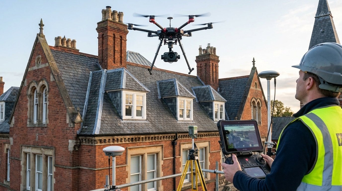
Drone technology has transformed property surveying, providing safe, cost-effective access to difficult-to-reach areas while capturing detailed imagery impossible with traditional methods. As RICS surveyors integrating drone technology into our survey practice, we've seen firsthand how UAVs (Unmanned Aerial Vehicles) enhance property assessments across West End London. This guide explains how drone surveys work, their applications, benefits, and what property owners should expect from this innovative technology.
What Are Drone Surveys?
Drone surveys use remotely-piloted aircraft equipped with high-resolution cameras, thermal sensors, and specialized equipment to inspect buildings from the air. Professional surveyors analyze captured footage to assess property condition without requiring scaffolding, rope access, or other expensive access methods.
Key Capabilities:
- High-resolution imagery: 20+ megapixel cameras capturing minute details
- 4K/8K video: Comprehensive visual records
- Thermal imaging: Heat loss and moisture detection
- 3D modeling: Accurate property measurements and models
- Close proximity inspection: Detailed examination without physical access
Applications in Property Surveying
Roof Inspections
The most common drone survey application:
- Assess slate/tile condition without scaffolding
- Identify missing or damaged roof coverings
- Inspect chimney stacks and pointing
- Examine lead valleys and flashings
- Assess parapet walls and hidden gutters
- Detect moss growth, vegetation, and biological growth
Cost savings: £300-£800 vs. £1,500-£4,000 for scaffolding access
Thermal Imaging Surveys
Infrared cameras detect temperature variations revealing:
- Heat loss: Inadequate insulation, thermal bridging
- Moisture ingress: Hidden leaks, damp penetration (cooler areas)
- Air leakage: Draught sources reducing energy efficiency
- Structural defects: Delamination, voids behind render
- Services issues: Underfloor heating faults, pipe leaks
Applications: Pre-purchase surveys, energy efficiency assessments, building pathology investigations
Facade Inspections
Examine external walls and architectural features:
- Brickwork condition and repointing needs
- Render defects and cracking
- Window condition (particularly upper floors)
- Architectural detailing and decorative features
- Structural movement indicators
- Rainwater goods (gutters, downpipes)
Pre-Purchase Surveys
Enhance traditional RICS building surveys:
- Comprehensive roof coverage not visible from ground
- Detailed photographic evidence for reports
- Identify defects before committing to purchase
- Provide negotiation evidence
- Baseline condition records
Insurance Claims
Document damage for insurance purposes:
- Storm damage assessment
- Fire damage extent
- Impact damage documentation
- Pre- and post-repair condition comparisons
Project Monitoring
Track construction and renovation progress:
- Regular aerial progress photography
- Quality control documentation
- Health & safety monitoring
- Marketing imagery for developers
Planned Maintenance
Regular condition monitoring for:
- Commercial property portfolios
- Landlord property management
- Historic buildings requiring ongoing monitoring
- Educational institutions, hospitals, public buildings
Advantages of Drone Surveys
Safety
- No height working: Eliminates surveyor risk
- No scaffolding required: Removes construction hazards
- Safe inspection of dangerous areas: Unstable roofs, damaged structures
- Reduced public risk: No overhead work in populated areas
Cost-Effectiveness
- No scaffolding costs: Savings of £1,000-£3,000+
- Faster surveys: Complete in 1-2 hours vs. days for traditional access
- No disruption: Building remains fully operational
- Repeat surveys economical: Easy to re-inspect after repairs
Quality and Detail
- High-resolution imagery: Captures details impossible to see from ground or ladder
- Multiple perspectives: View from any angle
- Permanent record: Detailed photographic/video documentation
- Measurements possible: Photogrammetry provides accurate dimensions
Speed
- Rapid mobilization: Surveys booked and completed within days
- Quick data capture: 1-2 hours for comprehensive imagery
- Fast reporting: Reports delivered within 3-5 working days
- No weather delays: Operable in most conditions (except high winds/heavy rain)
Accessibility
- Inspect areas impossible to reach traditionally
- Survey tall buildings without expensive access equipment
- Examine concealed roof valleys and dormers
- Assess buildings with limited surrounding space
Limitations and Considerations
Weather Dependency
- Wind: Cannot fly in winds exceeding 25mph
- Rain: Heavy rain damages equipment and reduces visibility
- Poor light: Early morning/late evening reduces image quality
- Temperature: Thermal imaging requires specific temperature conditions
Not a Complete Replacement
Drone surveys complement but don't fully replace traditional surveys:
- Surface inspection only: Cannot detect underlying structural issues
- No tactile assessment: Can't test timber softness, material soundness
- Limited internal access: Won't inspect roof spaces, basements
- Professional interpretation required: Expert analysis essential
Regulatory Restrictions
Urban drone operations face constraints:
- CAA permissions: Commercial operators need specific certifications
- Flight restrictions: Near airports, government buildings, crowds
- Privacy considerations: Must respect neighboring property privacy
- Controlled airspace: Central London requires special authorizations
Choosing a Drone Survey Provider
Essential Qualifications:
- CAA Permission for Commercial Operations (PfCO): Legal requirement
- Public liability insurance: Minimum £5 million coverage
- Professional qualifications: RICS surveyors interpreting results
- Equipment quality: Professional-grade drones and cameras
- Thermal imaging capabilities: If required for moisture/energy surveys
Questions to Ask:
- Are your drone pilots CAA certified?
- Do you have appropriate insurance?
- Will a RICS surveyor analyze the results?
- What resolution cameras do you use?
- Do you provide thermal imaging?
- How quickly will I receive the report?
- What format will images/video be provided in?
Costs and Pricing
Typical Drone Survey Costs:
- Basic roof inspection: £300-£600
- Comprehensive building survey (with RICS report): £600-£1,200
- Thermal imaging survey: £500-£1,000
- 3D modeling/photogrammetry: £800-£2,000+
- Commercial building survey: £1,000-£3,000+
- Ongoing monitoring contracts: Negotiable rates
Compare to traditional access: Scaffolding for terraced house: £1,500-£3,000 | Cherry picker hire: £600-£1,200 per day
The Survey Process
Step 1: Consultation
- Discuss survey objectives
- Confirm property location and access
- Identify specific concerns
- Confirm pricing and timescales
Step 2: Pre-Flight Planning
- Check airspace restrictions
- Obtain necessary permissions
- Weather monitoring
- Risk assessment
Step 3: Data Capture
- Site survey (typically 1-2 hours)
- Multiple flight paths ensuring complete coverage
- High-resolution photography and video
- Thermal imaging if required
Step 4: Analysis and Reporting
- RICS surveyor reviews all imagery
- Defects identified and categorized
- Repair recommendations provided
- Comprehensive report with annotated images
Step 5: Delivery
- Full survey report (3-5 days typical turnaround)
- High-resolution images and video
- Follow-up consultation available
Future Developments
Drone survey technology continues advancing:
- AI image analysis: Automated defect detection
- LiDAR integration: Precise 3D modeling
- Improved sensors: Higher resolution, better thermal imaging
- Longer flight times: More comprehensive surveys
- Indoor drones: Internal inspection capabilities
- Automated flight plans: Consistent, repeatable surveys
Working with West End Surveyors
Our drone survey services combine cutting-edge technology with professional RICS expertise:
- CAA-certified commercial drone operators
- RICS surveyors interpreting results
- High-resolution 4K cameras and thermal imaging equipment
- Comprehensive survey reports meeting RICS standards
- £10 million public liability insurance
- Integration with traditional building surveys
- Fast turnaround (3-5 working days)
Conclusion: Embracing Survey Innovation
Drone technology has revolutionized property surveying, providing safer, faster, and more cost-effective building assessments. While not replacing traditional surveys entirely, drones offer exceptional value for roof inspections, thermal imaging, and facade examinations. Combined with professional RICS interpretation, drone surveys deliver the comprehensive property intelligence West End London property owners and buyers require.